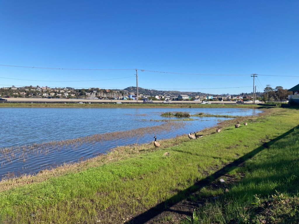
The “bomb cyclone” storm in late October walloped Marin County. Mt. Tamalpais received 21.7 inches of rain. Power outages, flooding and road closures affected thousands of residents.
In Southern Marin, the combination of heavy rain and high tides overwhelmed drainage systems and caused localized flooding. Low-lying Marin City may have been impacted more than any other community. When the only route in and out of the community of approximately 3,100 people became flooded, it left residents stranded for hours.
The flooding issue in Marin City isn’t new. Residents have complained about the inadequate drainage for years.
To explain why Marin City floods, Roger Leventhal, senior engineer for the Marin County Department of Public Works, points to the geography and development of the eastern shoreline in Marin County. The slopes of Mt. Tamalpais give way to narrow, flat land along the shoreline, which was once historical tidal wetlands. Wetlands are areas where water covers the terrain, either seasonally or year-round. The saturated soil promotes the growth of specially adapted plants, and provides a habitat for fish and wildlife. In addition, wetlands absorb storm- and flood-waters.
In the 1900s, development began on Marin’s eastern shoreline, with accelerated growth from the 1950s through the 1990s. Regrettably, we filled in the wetlands. The eastern shoreline of Marin, consequently, is one of the most flood-prone areas along the San Francisco Bay, according to Leventhal.
“Much of the development in Marin County, including Marin City, occurred along that relatively narrow eastern edge of historic tidal wetlands, resulting in the paving over, or ‘urbanization,’ of the drainage areas or watershed,” Leventhal said.
Watersheds typically hold stormwater and release it slowly, preventing flooding. By covering the watersheds with streets and buildings, we’ve created a water-resistant, flood-prone area. Paving over creeks and burying them into pipe systems intensifies the problem, as the conduits carry water very rapidly to the Bay.
In addition, the soft soil underneath Marin’s wetlands is now sinking under the weight of the paved roads and buildings. Double trouble.
“We have seen several feet of sinking at almost all the major utilities and roads of Southern Marin, such as the CalTrans Manzanita parking area down to Gate 6 at Marin City,” Leventhal said. “This results in areas that are too low to gravity-drain during higher tides and therefore flood.”
In 1953, after the development of much of the eastern shoreline, the Marin County Flood District was established to coordinate flood-reduction efforts. The District, divided into eight zones, is funded by a combination of property taxes and special assessments. Each flood zone manages its own financial resources.
Zone 3, which includes Marin City, covers 13 square miles and deals with flooding in areas adjacent to Richardson Bay. Unfortunately, the funding allocated to the zone doesn’t cover all the needed flood controls, with most of it going toward the maintenance of aging drainage and flood facilities.
No one needs to tell Marin City resident Terrie Green that the area has insufficient flood controls. Green, executive director of Marin City Climate Resilience and Health Justice, has worked tirelessly to get the county to address flooding in the community.
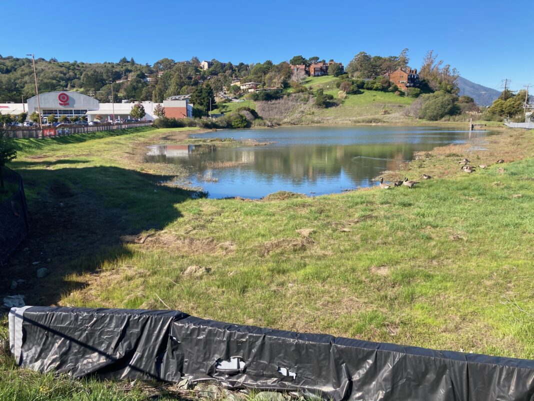
According to Leventhal, the problem is that Marin City is shaped like a large bowl, tilted on its side, that drains into a small, privately-owned pond located between Highway 101 and the Marin Gateway Shopping Center. The one small pipe connecting the pond to the Bay simply can’t drain the water fast enough during higher tides and major storms. The Bay tide level controls the drainage from the low-lying area of Marin City. During higher tides, the drainage system from the pond to the Bay backs up.

To make matters worse, the Marin City watershed has no upstream ponds or wetlands. Without storage areas, there is nothing to slow down the stormwater flow from the steep hillsides.
“That means floodwaters reach the bottom of the watershed quickly and can cause flooding, because there are limited outlets to send the water to the Bay,” Leventhal said. “There is also high groundwater in Marin City, due to its proximity to the Bay and underlying geology that also impacts drainage and the storage capacity of the pond.”
In addition, a small area dips down at the intersection of Drake Avenue and Donahue Street, retaining water. When the junction floods, the only entrance and exit to Marin City is inaccessible.
The Highway 101 off-ramp at the Sausalito/Marin City exit also drains stormwater into the overburdened pond. That, too, can trigger flooding. It also creates another problem, according to Green.
“We have 12 acres of runoff coming off Highway 101 into Marin City,” Green said. “The water is contaminated. Just google ‘highway runoff.’ We don’t want toxic waters coming into Marin City or going out to our wetlands and Richardson Bay.”
Marin City has been flooding for 80 years, and the County has failed to make necessary improvements, while other flood-prone areas in Marin have been upgraded, according to Green.
In early 2018, the Marin County Flood Control District released the “Marin City Drainage Study.” The 317-page report evaluated the current flood protection, identified the inadequate drainage-system structures and defined structure improvements. The study recommended a second culvert from the pond to Richardson Bay.
The District is currently in the design and permitting phase for the improvement project, which includes plans to bore a second culvert under Highway 101 and construct a new flood wall around the pond, Leventhal said. Yet, this is only an interim solution. As sea levels rise, this upgrade won’t be sufficient to prevent flooding. Longer-term solutions are needed.
Sea level rise and increased rainfall intensity due to climate change will form a “perfect storm for flooding,” according to Leventhal.
Still, the District is moving forward with the second culvert. To defray the costs of the project, the District applied for a FEMA grant, which was approved last year. The total grant amount is approximately $2 million. Flood Zone 3 has allocated approximately $1 million of its own money for the project, with an additional million dollars in reserve.
The installation cost for the second culvert and new flood wall was originally estimated at $3.2 million; however, the design phase has already hit a couple of significant bumps. In fact, the District is applying to FEMA for a one-year extension to finish the design. The anticipated design completion date is now March 23, 2023.
Unfortunately, the delay is necessary, according to Leventhal. Since the pond is privately owned, the District has lacked access to conduct the design work. In addition, the plan to place the new culvert under Highway 101—by using trenchless technology—must be reassessed due to recent geotechnical studies.
The District and CalTrans are working together to examine other methods of installing the new culvert. One concept involves “open trenching” across 101.
“As you can imagine, this is potentially a major project to a major freeway, so additional time and field investigation is required before CalTrans will entertain such a major construction approach and significant impact to Highway 101 traffic,” Leventhal said.
Whether FEMA grants the extension, and whether the allocated funds will cover the costs of a new design, remain to be seen. If the current FEMA funding is lost, the District will seek other grants.
Green remains skeptical. After years of advocating for flood controls in Marin City with no results, she’s frustrated. Most of all, Green is concerned that when Marin City floods residents will be forced to trudge through toxic floodwaters and emergency vehicles will struggle to traverse inundated streets.
“I want to hear the County make some commitments to us,” Green said. “When are they going to deliver?”
Marin County Supervisor Stephanie Moulton-Peters acknowledges that Marin City has a long-standing flooding problem and that the County must act. She also wants to assure residents their needs will be met during an emergency. The County is currently working on an emergency preparedness plan with schools.
“I have spoken with the County fire department and the Department of Emergency Services,” Moulton-Peters said. “I’ve been told they do have equipment to get people out of Marin City during a flood, including trucks, skiffs and boats.”
Moulton-Peters also said there are three Marin City flooding projects on the horizon with the Marin County Department of Public Works and CalTrans. The first is to upgrade the pond drainage. Another involves mitigating flooding from the 101 off-ramp into Marin City. A longer-term project includes improving the stretch of highway from Tam Valley to Sausalito.
“We will get solutions in place,” Moulton-Peters said. “CalTrans will be put in the budget this coming year, and I expect the first improvements will come in the next 12 to 18 months.”


